An Overview of Bay Ridge
It is important that before diving into a subject, that the audience has an idea of what you are talking about. That is why the first step in looking at local history would be to identify the area you are looking at, and creating a baseline of factual information. For a classroom setting, this would be a beneficial point to create a pre-assessment to properly gauge the prior knowledge of the students.
The neighborhood of Bay Ridge is located in the south-west corner of the Borough of Brooklyn. The neighborhood borders the Narrows River to the west, Dyker Heights to the east, Sunset Park to the north, and Fort Hamilton Army Base to the south. With a population of almost 80,000 according to the 2010 census, Bay Ridge is home to a wide variety of cultures.
The image below shows a breakdown of the population in Bay Ridge. While it is a close, 50/50 ratio of male to females, there are slightly more females in Bay Ridge. Another point of interest is the largest age range population is that of 25-29 and 30-34 year old's. This makes sense as many older 'millennials' are moving to Bay Ridge to start and grow their families. That helps connect the information to why the under 5 age range is also quite high. The only other larger age range would be 60-64 which contributes to the understanding that there are quite a few retired people who still live in Bay Ridge, and often participate in community events such as the St. Patrick's Day Parade and the Memorial Day Parades.
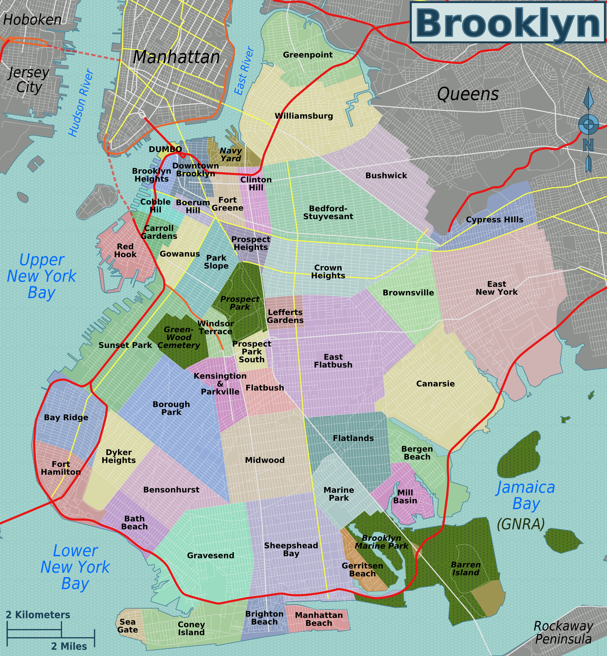
From the image below, you can see the highlighted neighborhoods. Bay Ridge is highlighted in blue and has a red circle almost outlining the neighborhood. That red line indicates highways, and Bay Ridge is almost entirely surrounded by highway. On the west, that is the Belt Parkway which connects Brooklyn to Long Island. On the east, the red line indicates the Bronx-Queens Expressway (BQE) which connects the Verrazzano Bridge (Staten Island) to Queens and the Bronx. These highways really help to connect Bay Ridge to the greater metropolitan area!
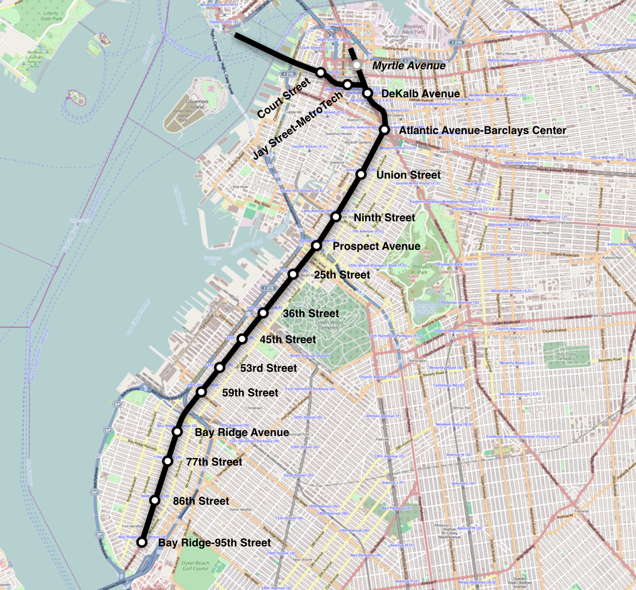
The image below is a map of the R train, which connects Bay Ridge to the rest of Brooklyn, and even the city. The R train runs along 4th Avenue, and it is a very popular mode of transportation for those who live in Bay Ridge and either work or go to school in the City. The first stop that enters into the actual neighborhood of Bay Ridge is the Bay Ridge Avenue stop, and the last of the whole line is the Bay Ridge-95th Street stop.
By sharing the maps and images above, with their descriptions, it allows for the audience or students to get a general sense of the neighborhood. The maps help the students to identify with common ways of commuting to the area, which they might be able to relate to. Maybe a family member takes the R train into work every day, or they always take the Belt Parkway when they come home from school. The students can gain a sense of place and can help frame the information that will soon be discussed. Especially when talking about the early history of Bay Ridge, where the natives and early settlers were scattered all around. The maps can help the students frame the locations of important historical events and even visualize the past settlers in their neighborhood.


.jpg)


Comments
Post a Comment